MOBILITY
Lytle Street: Rethinking the right-of-way.
The Challenge.
When Hazelwood Green is fully built out, approximately 4.5 miles of new rights-of-way will be built and dedicated to the City as public streets. The opportunity to design new urban rights-of-way from scratch is a rarity and posed a challenge - how can Hazelwood Green flip the script, prioritizing active transportation and transit riders before private vehicles? Lytle Street rethinks the allocation of right-of-way space for modes of mobility.


Lytle Street, Beehive Street, and Eliza Street were approved for public dedication by City Council on January 28, 2020, and officially opened to the public on January 30, 2020. Read the news coverage here.
The Design.
Lytle Street is a first for Pittsburgh – a truly people-first street – in several ways.
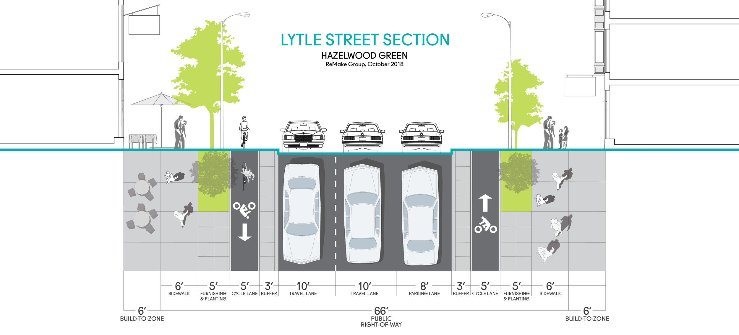
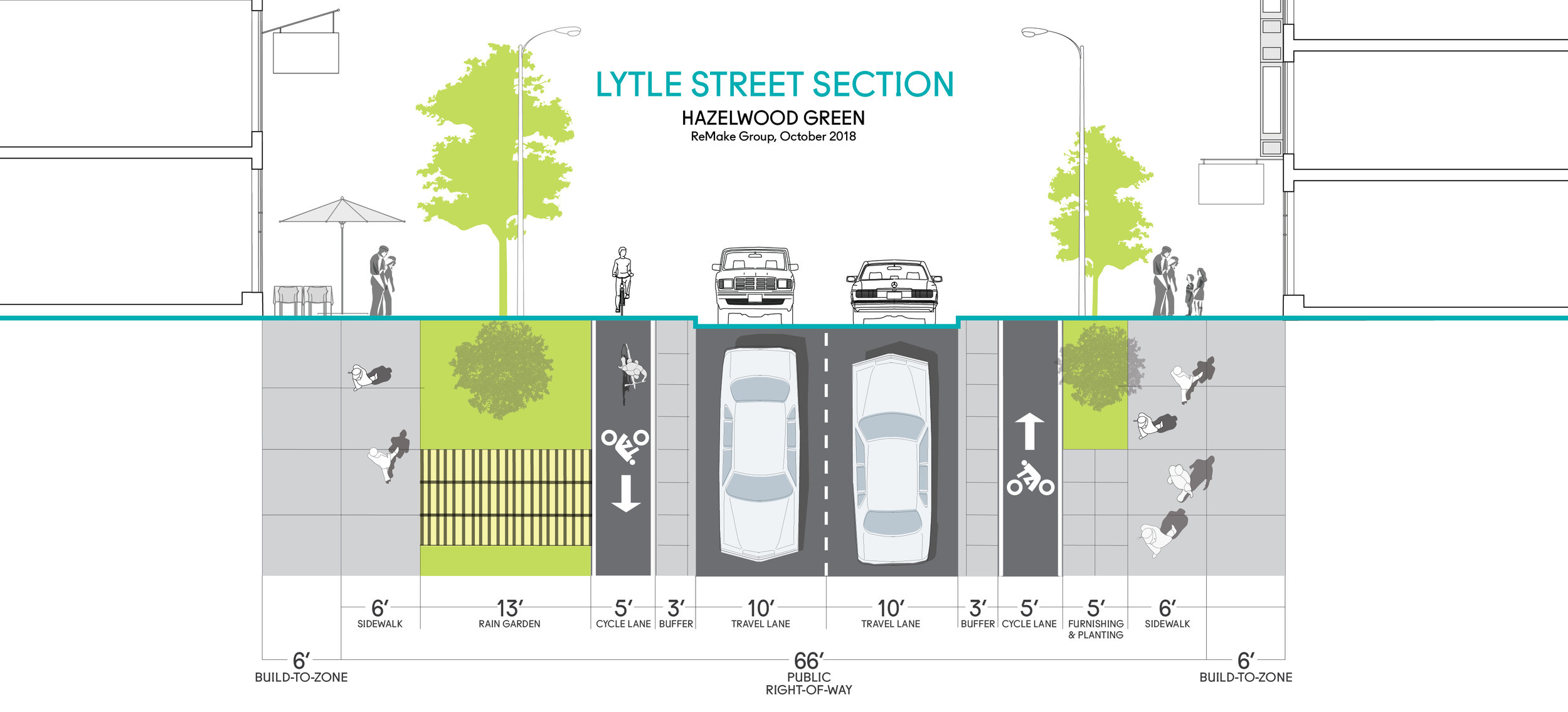
CHICANES & ALTERNATING PARKING. A chicane is a curb extension that creates a lane shift intended to slow vehicular traffic. In the case of Lytle Street, chicanes are also used as a tool to alternate street parking from either side of the street every block.
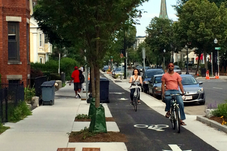
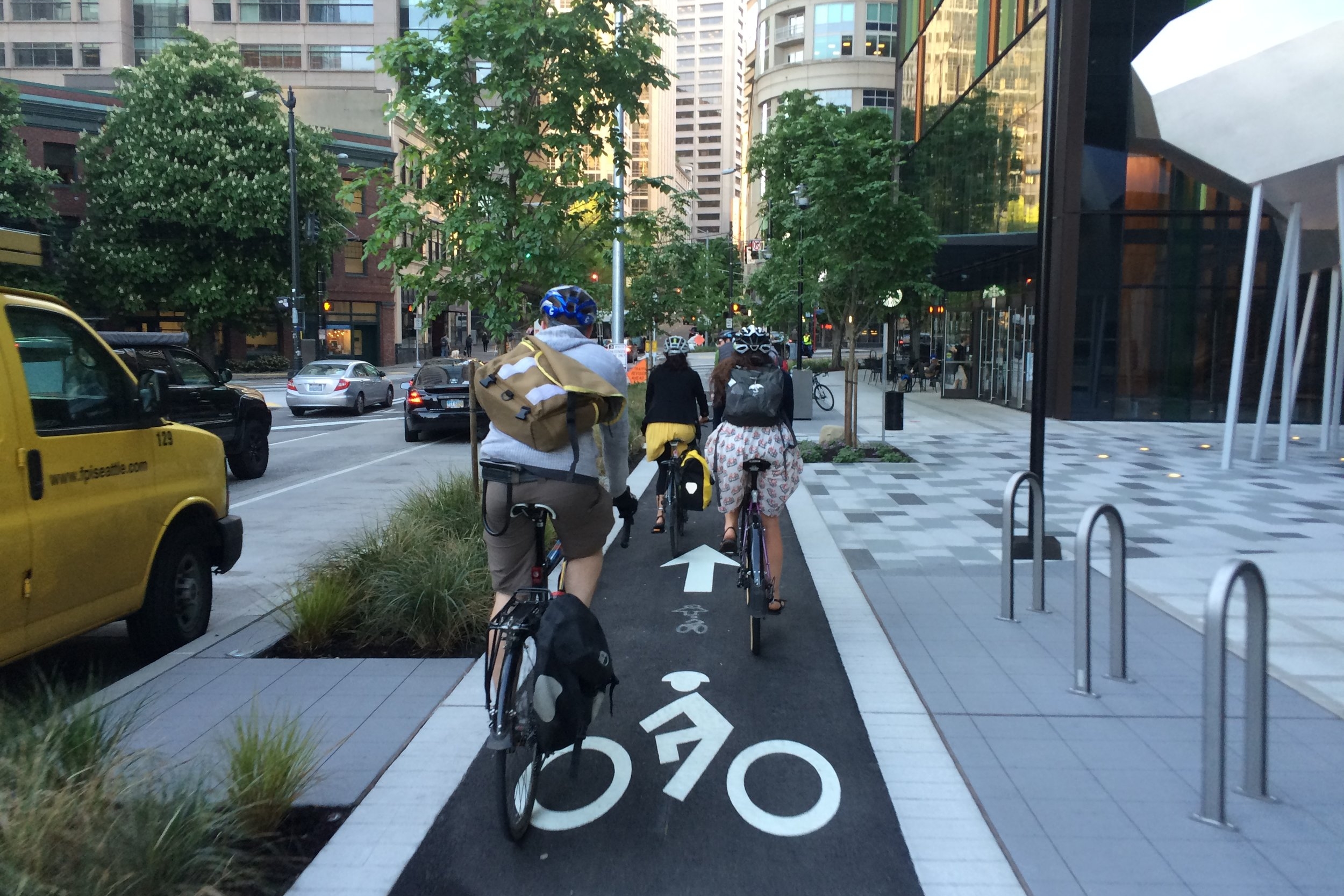
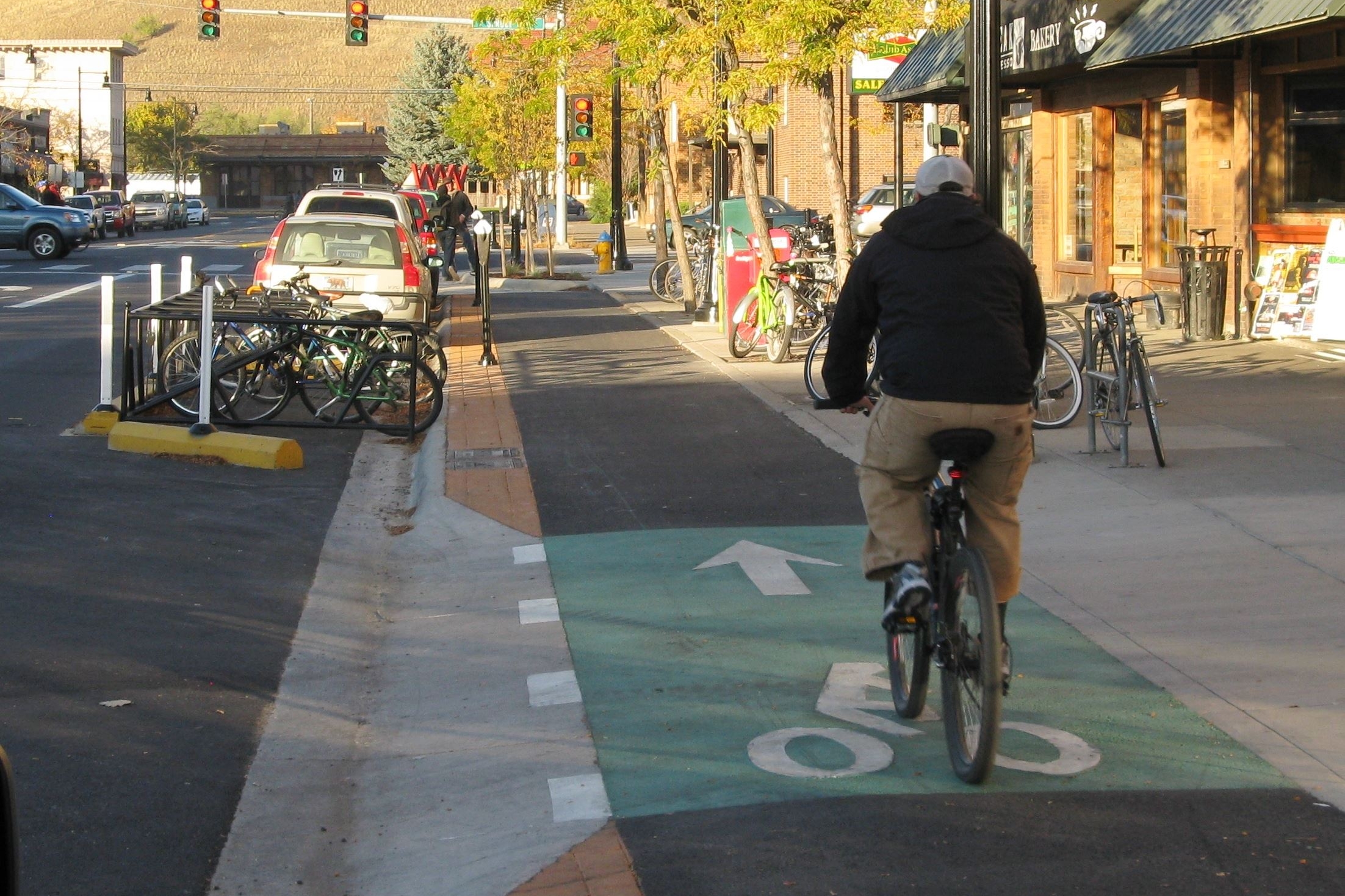
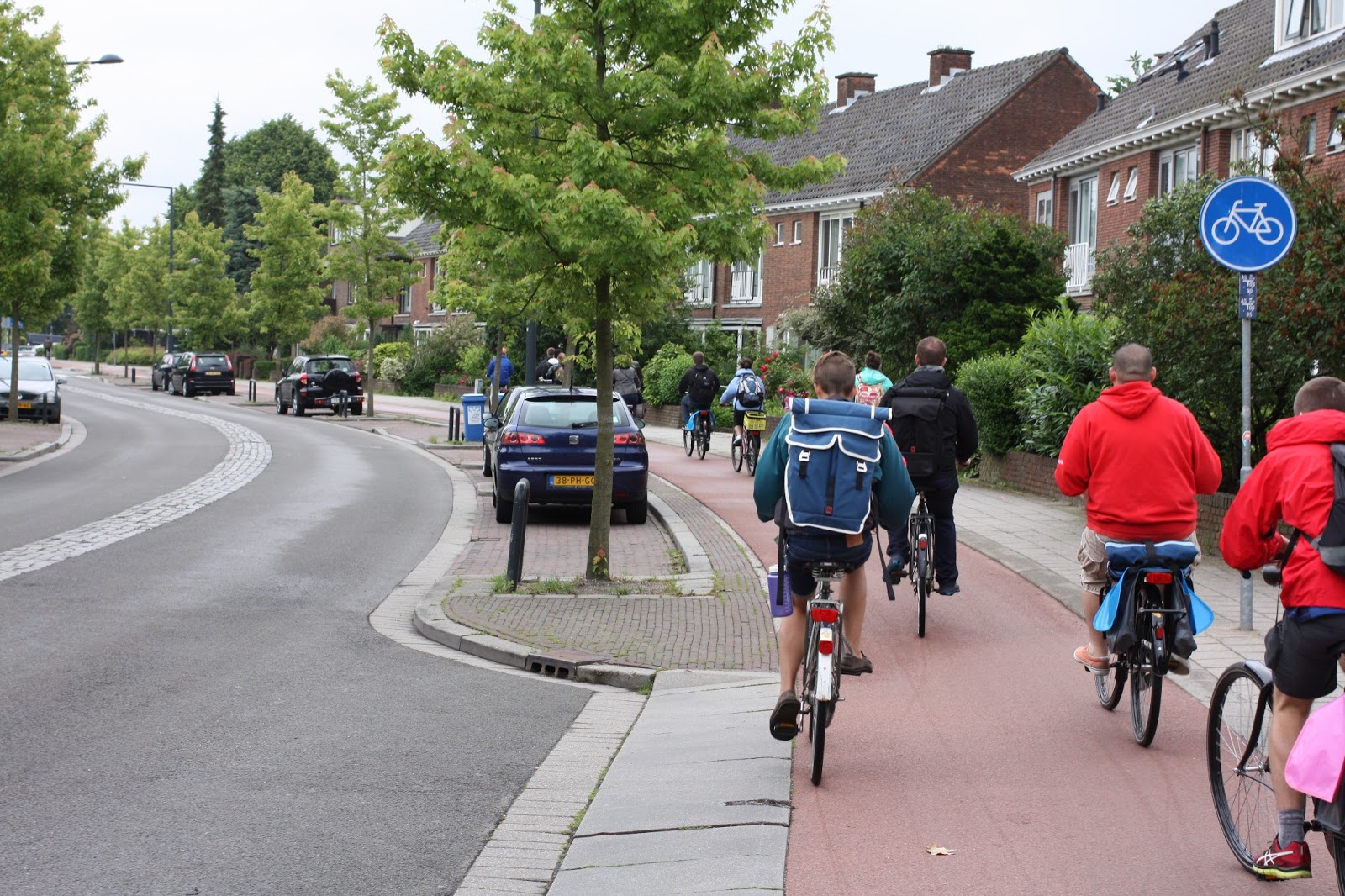
RAISED CYCLE LANES. Frequently seen in Europe, with only a handful of examples in North America, Lytle Street incorporates cycle lanes that are protected through grade separation. With a 3-foot buffer from the curb and a 5-foot planting and furnishing area that serves as a transition zone for pedestrians, the 5’ cycle lanes provide a comfortable and safe space for cyclists of all abilities. As of Fall (2018), the draft edition of American Association of State Highway and Transportation Officials’ Bike Guide includes (for the first time) protected bicycle lanes (including sidewalk level lanes) and protected intersections.
RAISED INTERSECTIONS. Most pedestrian and cyclist collisions occur at intersections, where conflicts between all modes are most frequent. To address this challenge, Lytle Street employs raised intersections (aka a table-top intersection) that serves to (1) reduce vehicular speed through establishing an extended speed hump and (2) enable an uninterrupted pedestrian and cyclist travel path.
GREEN INFRASTRUCTURE. Street trees on Lytle Street are on average every 30 feet to ensure a good canopy, which in turn will create a more comfortable streetscape, slow traffic, filter air and rainwater, and provide shade for pedestrians. In addition to providing ample space for the street trees to grow and absorb rainwater, three blocks of Lytle Street are also acting as a pilot to test and demonstrate the effectiveness of green infrastructure in managing and filtering rainwater. The three blocks of Lytle Street along the front of the Mill 19 building employ 100% green infrastructure (i.e. swales and planting instead of pipes) to manage and convey rainwater to the retention area north of the street (on Block 15).

Notes.
DESIGN SPEEDS.
The terms “pedestrians” and “cyclists” are not intended to be exclusive of other modes, but rather to easily define two different speeds of travel in each lane; the sidewalk and cycle lane, respectively. One should consider that sidewalks, while designed to pedestrians should accommodate modes that travel at speeds between 0 and 4 miles per hour. Similarly, the cycle lane - primarily designed for cyclists - is suitable for other modes (i.e. rollerbladers, skateboarders, scooters, joggers, etc.) that travel 5 and 15 miles per hour. Finally, there are those whether on a bicycle, electric-assist bicycle, and/or scooter that are comfortable and able to travel at similar speeds to vehicles (15mph+), this group may choose to mix with vehicular traffic in the travel lanes on-street.
CHARACTER OF LYTLE STREET.
Lytle Street is Hazelwood Green’s only north-south Secondary Street and serves as the site’s main pedestrian-oriented street, where active ground floor uses and pedestrian activity shall be focused and concentrated. The street are being monitored with two bicycle and pedestrian counters (Eco-Counter) for performance to advance future duplication. It is anticipated that Lytle Street will incorporate public amenities, public art installations and interventions, and facilities to accommodate festivals, block parties, and other special events in coordination with activity on the Plaza.
Beehive & Eliza Streets
The Lytle Street project also includes Beehive Street and Eliza Street. Beehive Street is designed in the same vein as Lytle with the main exception of 11-foot travel lanes (instead of 10-foot) to better accommodate larger vehicles, i.e. trucks and buses. Eliza Street is a more traditional street, and is identified as a ‘Neighborhood Street’ in the PLDP.